Rainbow Hot Springs. The hot springs located in the backcountry near Pagosa Springs.
This is a pretty popular trail here given the final destination. It’s a five mile hike that gradually ascends about 1,000 ft. And then you get to do it again in reverse on your way out, totaling ten miles and 1,637 feet of climbing. The Rainbow Trail is part of the West Fork Trail #561. Most visitors hike to the Rainbow Hot Springs and back. But you can continue on to the Continental Divide Trail at Piedra Pass for a one-way total of 11.9 miles and an elevation gain of 3,600 feet.
The trail head is easy to get to. It’s down a dirt road that goes by a couple of campgrounds with many dispersed sites once you get near the West Fork River. You don’t need four wheel drive. Just be careful during heavy rains as it can get muddy.
During the summer, this trail can get busy. I went on a Wednesday morning in mid August, past the prime tourist season. And overall, I saw probably about twenty people coming and going. Most of them were camping overnight at the hot springs. On weekends, it’s definitely more busy.
The trail starts off at a private road that leads past a few cabins and large ranch. At about half a mile in, you pass the ranch and begin down the trail easement located through the ranch. There are many signs posted to stay on the trail. And for the most part, you don’t have a choice because of the fence on the west side and the steep drop off on the east side as you’re headed north.
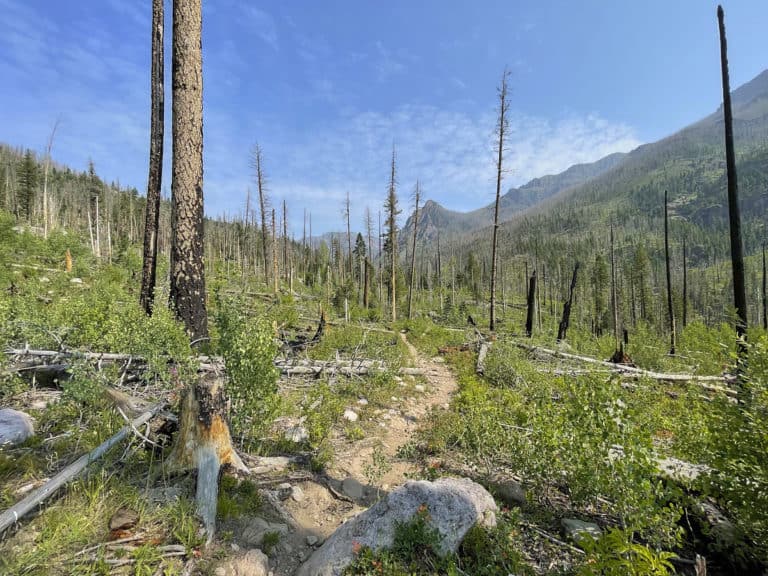
A mile and a half in is where you enter the Weminuche Wilderness area. Back in 2013, there was a huge fire out here that burned more than a 100,000 acres. Combined with the beetle bug devastation, there are tons of trees down everywhere. And just a few years ago, huge avalanches took all these dead trees and deposited them across the trail and down into the river. It really is quite the site to see as you’re walking through these areas that have been impacted. But the Forest Service has done a remarkable job at clearing the trail and hot springs. And it’s all easily accessible today.
The hot springs are located five miles in. Now there’s not much shade on this hike due to the wild fire and beetle bug devastation. So be sure to plan ahead, bring plenty of water and sunscreen.
While hiking in and out the same day is easily doable, the preferred method is to camp overnight at the hot springs. Camping is only allowed in designated spots but each spot is near the springs. There’s a few hot springs located near Campsite 8. But the best and deepest one is in between campsites #6 and #7. Right before you get to Campsite 7, look for a small trail on your left and follow it down to the river. When you get to the river, follow the river south about twenty yards or so. And you’ll stumble upon the hot springs.
The hot springs are very comfortable. Probably in the upper 90’s depending on how much river water is seeping into the spring pool. And I enjoyed going back and forth between sitting in the hot springs and laying down in the river to cool off. It really did seem to help my muscles relax and recover from the hike.
The hot springs are a bit muddy. It’s more like a fine mulch that seems to easily spread throughout the water as soon as you step in. And it easily gets in your swim suit or shorts. So have a plan to get in the river and wash it all off. Clothes are optional for some. But overall, everyone is respectful. Just go with the flow.
Backpacking Rainbow Hot Springs and camping overnight seems to be the way most people choose to hike this trail. But it can easily be hiked in one day. It took me about three hours to hike the five miles in. But that included my time setting up the camera for various shots. I ended up hiking an extra mile from setting up all those shots. On the way back when I didn’t have to film anything, I was able to finish it in 90 minutes. So it’s a moderate day hike for an out and back. But most people camp out overnight to maximize their time in the hot springs.
For more trails in the Pagosa Springs area, head here.


